
5 Drop-Dead Gorgeous Day Hikes in California's Eastern Sierra Mountains
- Gabriella Viola
- Aug 31, 2023
- 6 min read
Updated: May 2
Crystal-clear lakes, alpine meadows, jagged peaks, and more. Discover some of the best hikes in the Eastern Sierra!

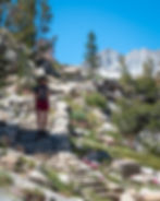
The Eastern Sierra is home to some of the most awe-inspiring and diverse hiking trails in California. The region is known for its dramatic mountain vistas, pristine alpine lakes, and abundant outdoor recreational opportunities. The trails in the Eastern Sierra cater to a wide range of skill levels and interests, from beginners looking for a scenic day hike to seasoned adventurers craving rugged challenges and high-altitude experiences.
In this post, I'm sharing 5 Drop-Dead Gorgeous Day Hikes in California's Eastern Sierra Mountains.
*When exploring the outdoors, help keep it beautiful by leaving no trace.

Before we get started, here are a few tips for hiking in the Eastern Sierra.
Best Time of Year:
Typically, June through early October is the best time of year for hiking in the Eastern Sierra.
Permits:
Most day hikes in the Eastern Sierra do not require a permit. However, almost all backpacking and overnight hikes do require one. You can find more information about obtaining a permit here.
Alltrails App:
Many of the hiking trails in the Eastern Sierra region do not have service. It's always a good idea to download the trail ahead of time (while you still have service) for peace of mind. Occasionally, the trail might not be so obvious, and it's always nice to be able to pull out your phone and make sure you are still on track.

Recommended Packing List
Sunscreen.
A hat for added protection.
Sturdy and preferably waterproof hiking boots.
Extra socks (come in handy for stream crossings).
Bug Spray (the mosquitoes can be relentless, so don't forget this one!)
Snacks/lunch.
Plenty of water (more than you think you need).
Bathing suit.
Camera.
WATCH THE VIDEO VERSION HERE:
1. Blue Lake

Hike Stats:
Trailhead: Sabrina Lake Trailhead at the end of State Route 168.
Length: 7 miles round-trip.
Elevation gain: 1,380 ft.
Trail type: Out-and-back.
Difficulty: Moderate/Hard.
Fee/Permit: None for a day hike. A Permit is required for overnight camping.

Starting at Lake Sabrina, the trail to Blue Lake is about 3.5 miles one way (7 miles out and back). Alltrails.com marks this trail at 5.9 miles round-trip, but I clocked it at just over 7 miles with the Alltrails app running. The first section of the trail climbs above Lake Sabrina, and there are several overlooks to take in the views. There is a small stream crossing, about shin length (this is where those extra socks come in handy), before the trail enters the trees and climbs a series of rocky switchbacks up the hillside. Eventually, you will reach Blue Lake, one of the most stunning lakes in the Eastern Sierras, with its bright blue, crystal clear water and impressive snowcapped granite peaks.
Getting to the Trailhead
The trailhead to Blue Lake is at Lake Sabrina, which is at the end of State Route 168, about 19 miles from Bishop, California. After passing Lake Sabrina Campground, look for the trailhead on the left. There are information boards at the start of the trailhead, but they’re not super noticeable. Alltrails.com should lead you right to the trailhead, so make sure to download the trail ahead of time. There is no service along Route 168. You can park along the road or in the day-use parking lot near the trailhead.

2. Little Lakes Valley

Hike Stats:
Trailhead: Mosquito Flat Trailhead at the end of Rock Creek Road.
Length: 8 miles round-trip.
Elevation gain: 1,200 ft.
Trail type: Out-and-back.
Difficulty: Easy/Moderate.
Fee/Permit: None for a day hike. A permit is required for overnight camping.


Little Lakes Valley is one of the most picturesque hikes in the Eastern Sierra. The trail follows a creek and passes a string of alpine lakes before reaching the ultimate reward, Gem Lakes. What truly makes the Little Lakes Valley hike special is that the entire trail is incredibly scenic, not just the view at the end. It has everything you could ask for - impressive mountain peaks, refreshing streams, scenic meadows, and sparkling lakes. Not to mention, the trail is relatively easygoing, although long at 8 miles round-trip.
Getting to the Trailhead
Located between Bishop and Mammoth Lakes, the Little Lakes Valley Trailhead is at the top of Rock Creek Road near Mosquito Flat Campground. Take HWY 395 to Tom’s Place and turn right onto Rock Creek Road. It’s another 11 miles up to the Mosquito Flat parking area. This is a very popular trail, and the parking area fills up quickly. I recommend getting there before 8 a.m. or visiting on a weekday.
3. Big Pine Lakes

Hike Stats:
Trailhead: Big Pine Creek Campground at the end of Glacier Lodge Road.
Length: 13 miles round-trip (from the trailhead to 3rd Lake).
Elevation gain: 2900 ft.
Trail type: Out-and-back.
Difficulty: Strenuous.
Fee/Permit: None for a day hike. A Permit is required for overnight camping.


Located near Bishop, California, the Big Pine Lakes hike features some of the most incredible scenery in the Eastern Sierra, but you'll have to earn the views. There are 7 Big Pine Lakes, numbered sequentially. Lakes 1, 2, and 3 are known to be the most scenic and look like they belong in Banff National Park with their turquoise water and the majestic Temple Crag in the background.
The Big Pine Lakes hike is a popular backpacking hike, but can be done as a day hike if you hike to 2nd or 3rd Lake and then back. That being said, at 13 miles round trip and 3,000 ft of elevation gain, it's a challenging day hike. But the views are worth the effort.
Getting to the Trailhead
The Big Pine Creek North Fork Trail is located at the end of Glacier Lodge Road, about 15 miles south of Bishop, California. Since the location is rather remote, many people stay in Bishop or camp near the trailhead. Free parking is available at the base of the trail near Big Pine Creek Campground. As well as an overnight section.
4. Conness Lakes

Hike Stats:
Trailhead: Saddlebag Lake Trailhead at Saddlebag Lake Campground.
Length: 6.3 miles round-trip.
Elevation gain: 928 ft.
Trail type: Out-and-back.
Difficulty: Moderate.
Fee/Permit: None for day hiking. A Permit is required for overnight camping.

Just outside the east entrance of Yosemite National Park is one of the most stunning hikes in the Eastern Sierra. The trailhead to Conness Lakes starts at the Saddlebag Lake Campground. The first mile of the trail is a rocky scree field, which isn’t particularly fun to hike on, but it eventually opens up to an expansive, picturesque alpine meadow. You'll pass by the scenic Greenstone Lake before crossing a small stream and climbing a series of switchbacks next to a small waterfall. After passing the waterfall, you will arrive at Conness Lakes, a series of glacier-fed, turquoise lakes with jagged peaks in the background.
Getting to the Trailhead
The entrance to the road that leads to Saddlebag Lake is just east of the Tioga Pass Road entrance to Yosemite National Park. From Tioga Pass, you'll travel along an unpaved road for several miles until you reach the trailhead at Saddlebag Lake campground.
5. Parker Lake

Hike Stats:
Trailhead: Parker Lake Trailhead at the end of Parker Lake Road.
Length: 3.6 miles round-trip.
Elevation gain: 646 ft.
Trail type: Out-and-back.
Difficulty: Easy/Moderate.
Fee/Permit: None for a day hike. A Permit is required for overnight camping.

Located near June Lake, California, in Mono County, Parker Lake is a relatively short and easy out-and-back trail that leads to a gorgeous alpine lake with a backdrop of the impressive Sierra Crest Peaks. The first half mile of the trail is exposed and uphill. However, the remainder of the trail is a pleasant shaded hike along a stream. If you're looking for a short hike with a big reward in the Eastern Sierra, Parker Lake certainly won't disappoint.
Getting to the Trailhead
The trailhead to Parker Lake is located near the junction of Highway 158 (June Lake Loop) and Highway 395. Turn off Highway 395 onto Highway 158 for slightly less than one mile. Turn right onto Parker Lake Road, which is a dirt road. Trailhead parking is in a small dirt lot at the end of Parker Lake Road.
Have you done any of these Eastern Sierra hikes? Which ones are on your bucket list? Let me know in the comments!
Be sure to subscribe to the blog so you don’t miss the latest blog posts, videos, and announcements! And of course, you can check out more adventures on YouTube and Instagram.
Some of the photos in this post were captured by @kirstenalexisadventures. Find her on Instagram!


